During April/May we have used GPS plotting to create a ‘grid’ for our site at the Burgage Green. We then carried out dowsing and geophysics, and obtained LIDAR imagery for the site.
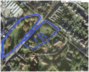
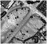
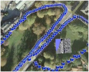
Below is a selection of images that show the progressive results from each of these elements – for the smaller side of the Burgage Green – all of which show a liner feature running north-south, parallel to Newark Road:

GPS plot showing Burgage Green ‘grid’ with linear feature highlighted picked up through dowsing (small side of Green) (©MBArchaeology, 2013)

LIDAR survey results of the Burgage, again showing a linear feature running across the smaller Green in direct correlation with the dowsing results (©Southwell Archaeology, 2013)

Geophysics results (Magnetometry) showing linear feature in direct correlation with dowsing and LIDAR results (©MBArchaeology/University of Nottingham,2013)
Our first three sets of test pits are being located on top of this linear feature to try and identify what it could be – our initial thoughts are that it is an old road / track – Day One of test pitting revealed what appeared to be part of a road/track surface
Project video
A provisional draft of the Burgage Earthworks project video has been uploaded to YouTube, showing the group in action during the surveying days of the project.
The video has been filmed and edited by two Year 9 students as part of their Duke of Edinburgh programme. Thanks go to Joe Bates (Minster School, Southwell) & Alfie MacDonald (Arnold Hill Academy) for their efforts in putting the film together.
A second short film will follow later in the project showing the digging and Finds Analysis element.
Click the image to watch the video:
